“Bomb Cyclone” Could Strike Northeast Wednesday, Unleashing Intense Rain And Winds
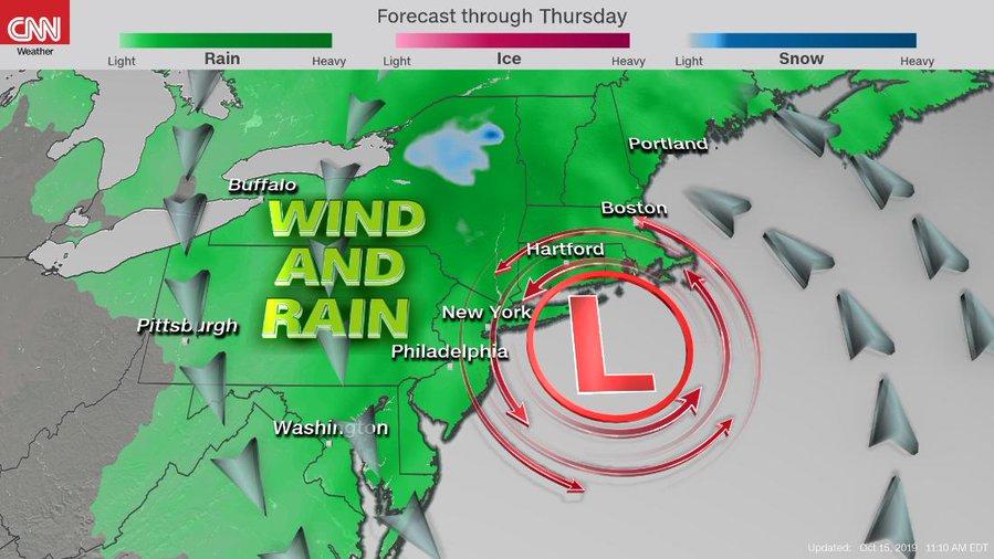
A nor’easter packing high winds and torrential rain is headed to the Mid-Atlantic and Northeast regions on Wednesday.
The powerful storm could be one of the strongest nor’easters on record for October. If the storm strengthens in the next 24 hours, it could be classified as a meteorological “bomb.”
Maryland, New Jersey, New York, and other coastal states in the Northeast could see as much as 3 inches of rain beginning Wednesday.
The storm is expected to organize in the Southeast late Tuesday and move up the coast and strike New York City by Wednesday evening.
“A very strong coastal storm is expected to impact the Northeast Wednesday into Wednesday night, including areas from Washington DC to Boston. This storm will rapidly strengthen off the Mid-Atlantic coast, and move northward into southern New England into Wednesday night. This will produce 1 to 3 inches of rainfall from southeast Pennsylvania to Boston along with wind gusts 30-50mph. This will promote rough ocean waters, coastal flooding, and isolated power outages and downed trees, particularly nearer the coastline. Localized flooding is also expected thanks to high rainfall rates, especially Wednesday afternoon and night. This storm will slowly move away Thursday,” stated Ed Vallee, head meteorologist at Vallee Weather Consulting.
Weather models are suggesting that at some point tomorrow, the storm could strengthen so quickly that it would be classified as a “bomb cyclone.”
Potential bombogenesis late Wed/Thu along New England coast as nor’easter develops with wind driven heavy rain and a little interior elevation #snow. pic.twitter.com/FkR1tHjUK8
— Michael Palmer (@MPalmerTWC) October 15, 2019
Other models show winds could reach tropical storm-force (+40 mph) on Wednesday and Thursday for parts of New York City, Boston, and Portland. These winds could produce widespread power outages and damage critical infrastructure in the Northeast.
UPDATE: The #Noreaster spinning southeast of #MarthasVineyard is bringing #TropicalStorm-force winds to parts of #NewEngland as NOAA’s #GOES16 captured what appears to be an eye developing this morning. It could become a #SubtropicalStorm later today. https://t.co/oMuv0mLHtC pic.twitter.com/7Rjl1qJSCt
— NOAA Satellites – Public Affairs (@NOAASatellitePA) October 11, 2019
Airports in the Mid-Atlantic and Northeast will likely see delays starting Wednesday afternoon through Thursday. High wind will be the primary factor for delays.
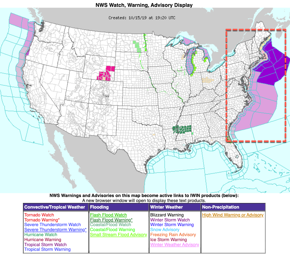
Storm and gale warnings have already been issued up and down the East Coast.
For parts of upstate New York, this nor’easter could usher in the first snowstorm of the year.
Tyler Durden
Tue, 10/15/2019 – 18:20
via ZeroHedge News https://ift.tt/2MHMOyh Tyler Durden

