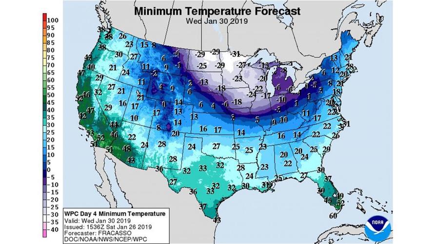
A massive blast of Arctic air will hit the Midwest and Northeast by the middle of this week, bringing temperatures to their lowest levels in years.
According to the National Weather Service, the hardest hit zone will stretch from Minnesota and Iowa through Michigan – including Chicago, Detroit, Des Moines, Green Bay, Milwaukee and Madison.
The Chicago Weather Service office has predicted temperatures below zero for 60 consecutive hours – from Tuesday afternoon through Thursday. “Only eight times since 1872 has Chicago recorded subzero highs on at least two consecutive days, the most recent being early February 1996,” it announced.
Milwaukee and Madison also face bone-chilling cold. In its forecast discussion for the region, the Weather Service wrote that the danger of the predicted temperatures “can’t be overstated,” noting they will be 30 to 40 degrees below normal. “For January, that’s incredible,” it said. –WaPo
All of Wisconsin and Minnesota, along with much of northern Illinois is expected to remain below zero on Wednesday.
“There’s no mild way of saying it. Brutal cold is coming,” said the National Weather Service, adding “It’s forecast as the prolonged coldest in at least 5 years, but potentially much longer.“
There’s no mild way of saying it. Brutal cold is coming.
While forecast specifics will be further refined, the frigid cold with wind will provide very low wind chills. It’s forecast as the prolonged coldest in at least 5 years, but potentially much longer.#ILwx #INwx pic.twitter.com/P93xv5Vlzo
— NWS Chicago (@NWSChicago) January 26, 2019
Wonderful way to visualize the polar vortex …
The features arrive from the Canadian Arctic — and sometimes they make it into the Lower 48
e.g. GFS (tropopause temperatures) pic.twitter.com/oEvyFdpLdw— Ryan Maue (@RyanMaue) January 25, 2019
“Temperatures can be held 20 to 40 degrees Fahrenheit below normal across most of the Midwest around midweek,” said AccuWeather Senior Meteorologist Brett Anderson.
That can equate to one to three days of subzero highs from Fargo, North Dakota, to Minneapolis and Chicago. Highs may reach only the single digits from St. Louis to Indianapolis and Pittsburgh.
Records for the cold can be challenged both during the day and at night.
“Latest indications are that Chicago could set a record on Wednesday for the day’s lowest high temperature,” according to AccuWeather Senior Meteorologist Tom Kines. Temperatures have not been held below zero for an entire day in Chicago since Jan. 6, 2014. –Accuweather
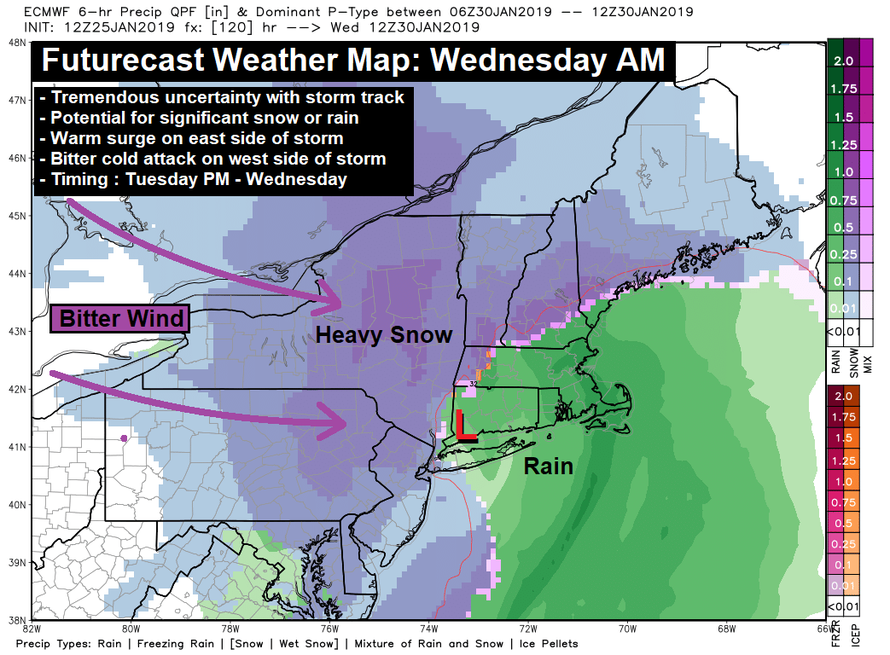
The Northeast will receive a heavy dose of snow and freezing winds, along with heavy rain according to Hudson Valley Weather.
We’ve got a VERY complex setup, with a monster dip in the jet stream, that will try to dig in, causing a coastal storm to develop. The position, timing and strength are quite uncertain, and very key to our forecast. In short… snow could cause headaches Tuesday afternoon into Wednesday morning. –Hudson Valley Weather
Residents in the affected regions are advised to remain indoors, protect livestock, and prepare for things like frozen pipes and dead car batteries. Motorists should have a winter survival kit in case of a breakdown.
12z GFS printing out 850mb temperatures down to -44ᵒC in the CONUS on Tuesday.
This is a bonafide arctic airmass. CONUS-wide record low 850mb temp is -42.1ᵒC at International Falls. pic.twitter.com/8ma39DyK2U
— Sam Lillo (@splillo) January 25, 2019
via ZeroHedge News http://bit.ly/2MzjHwn Tyler Durden

