A San Francisco-based aerospace company has begun to revolutionize space-based spying after launching a “fleet” of nearly 300 satellites into orbit – nearly half of which were sent up last year.
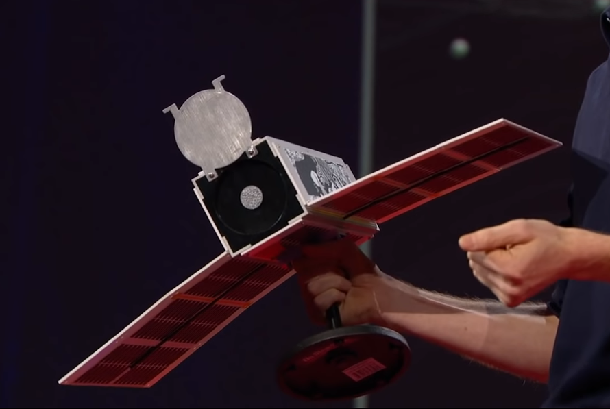
Founded in 2010 by ex-NASA scientists Will Marshall, Robbie Schingler and Chris Boshuizen, Planet Labs has perfected the art of shrinking truck sized surveillance satellites down to the size of a loaf of bread. Planet now has just over 400 employees, most of them in San Francisco.
Packed with some of the same electronics used in smartphones, the satellites are known as “doves,” which sit in their “nests” until they are ready to be launched in “flocks,” where they join an array of satellites which can image the entire earth once every 24-hours – flooding data centers with a stream of 1.2 million pictures each day.
“It’s a line-scanner for the planet,” said Marshall during a 2014 Ted Talk.
The images can then be manually compared, or fed into algorithms which can look for minor changes such as new roads or building construction.
“I’m always astonished that almost every picture we get down, we compare it to the picture from yesterday, and something’s changed,” says Marshall, who sat down with 60 Minutes. “We see rivers move, we see trees go down, we see vehicles move, we see road surfaces change and it gives you a perspective of the planet as a dynamic and evolving thing that we need to take care of.“
While most of the Planet’s 200-plus customers are agricultural companies looking to monitor the health of their crops, their most important customer is the National Geospacial Intelligence Agency (NGA) – the government body responsible for analyzing satellite photos from its 2.7 million square-foot headquarters south of Washington D.C. staffed with 14,500 employees.
“I’m quite excited about capabilities such as what Planet’s putting up in space,” says NGA director Robert Cardillo.
It’s space-age hide and seek. Adversaries know when and where American spy satellites are looking but can never be sure what they’re finding.
Robert Cardillo: This is what NGA developed in the pursuit of Osama bin Laden.
Before President Obama and his national security team, including Cardillo there on the left, gathered in the White House Situation Room on the night of the raid, NGA had gone back in time through seven years of satellite imagery to construct this scale model of Bin Laden’s hideout.
Robert Cardillo: We had historic imagery of this compound that enabled us to reverse time.
NGA could see not just the outside, but inside as well.
Robert Cardillo: It enabled us to go back to the point of construction. And essentially through our imagery archive to rebuild the house so, we could see how the first floor was designed and how the rooms would lay out, where are the stairs from the first to the second floor and the second to the third floor.
David Martin: So old pictures show that building before the roof went on?
Robert Cardillo: We had pictures before the compound existed. We saw it when it was first constructed and as it, as it was built over time. Correct.
David Martin: And that’s how you could find out the dimensions of each room?
Robert Cardillo: Indeed. -60 Minutes

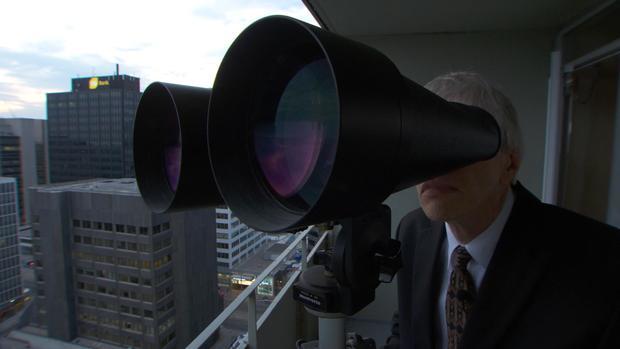
NGA’s capabilities are of course top secret, however they have been collecting the bulk of their images from three multi-billion dollar satellites the size of a city bus, according to satellite tracker Ted Molczan – who uses giant binoculars.
The satellites that made that possible are the equivalent of a Hubble Space Telescope. But instead of taking pictures of the heavens they are zeroed in on Earth, able to make out objects just four inches across.
For decades they have been indispensable to knowing what America’s adversaries are up to, but like Hubble they cost billions of dollars each. Which is one reason there are so few in orbit.
David Martin: Are they putting more up?
Ted Molczan: They’ve never had more than four up at a time.
Which is why Cardillo is so interested in Planet and its small satellites that deliver a tsunami of data like NGA has never seen. -60 Minutes

According to Robert Cardillo, the NGA would need six million humans to exploit all the imagery they have access to – which Planet’s Shawna Wolverton explains can be accomplished through algorithms.
Planet’s Shawna Wolverton showed us how a computer can be programmed to help track the impact of Syria’s Civil War on the people who live there.
Shawna Wolverton: So, what we’ve done is created a algorithm that looks for new roads and buildings.
An algorithm that rifled through reams of satellite photos and identified the first signs of a new refugee camp.
Shawna Wolverton: Here’s that first image.
David Martin: So, that red grid is what?
Shawna Wolverton: Those are new roads. And all of these blue spots that you can see here are buildings.
David Martin: So, this is one little corner of, of Syria. Could you do this for the entire country?
Shawna Wolverton: We can absolutely do this for the entire country. I can show you over here. We can zoom out. And you can see that we’ve run this algorithm over the entire country and you can see all of the roads and buildings. -60 Minutes
via ZeroHedge News http://bit.ly/2Sgra90 Tyler Durden
