Bahamas, Florida (And Alabama) Face More Devastation As Tropical Cyclone Looms
Potential Tropical Cyclone Nine is likely to become a tropical depression or tropical storm by Friday night and will pose a threat to the Bahamas, Florida and possibly other parts of the southern United States, including areas devastated by Hurricane Dorian.
A “potential tropical cyclone” allows the National Hurricane Center (NHC) to issue advisories, watches and warnings on systems that have yet to develop but pose a threat of bringing tropical-storm-force (39-plus mph) or hurricane-force (74-plus mph) winds to land areas within 48 hours.
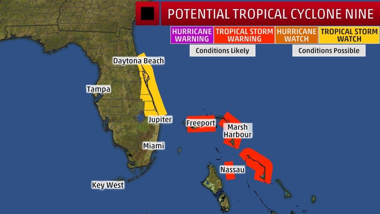
The NHC has posted a tropical storm warning for the northwestern Bahamas, except for Andros Island. This means tropical-storm-force winds are expected there within 36 hours.
The NHC has also issued a tropical storm watch for portions of the Florida east coast, from Jupiter Inlet to the Flagler/Volusia County line. This means tropical-storm-force winds are possible there, generally within 48 hours.
Watches and Warnings
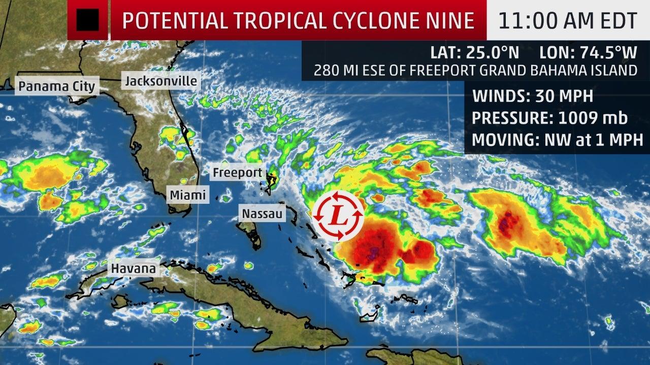
Potential Tropical Cyclone Nine is moving very slowly toward the northwestern Bahamas and producing clusters of showers and thunderstorms over the islands. These convective clusters have become more persistent over the past day.
This disturbance is expected to resume a northwestward motion later today and an increase in forward speed is anticipated this weekend.
Current Storm Status
The NHC says environmental conditions are favorable for a tropical depression or tropical storm to form within the next day or so and gives this system a high chance of development as it crawls toward the northwestern Bahamas.
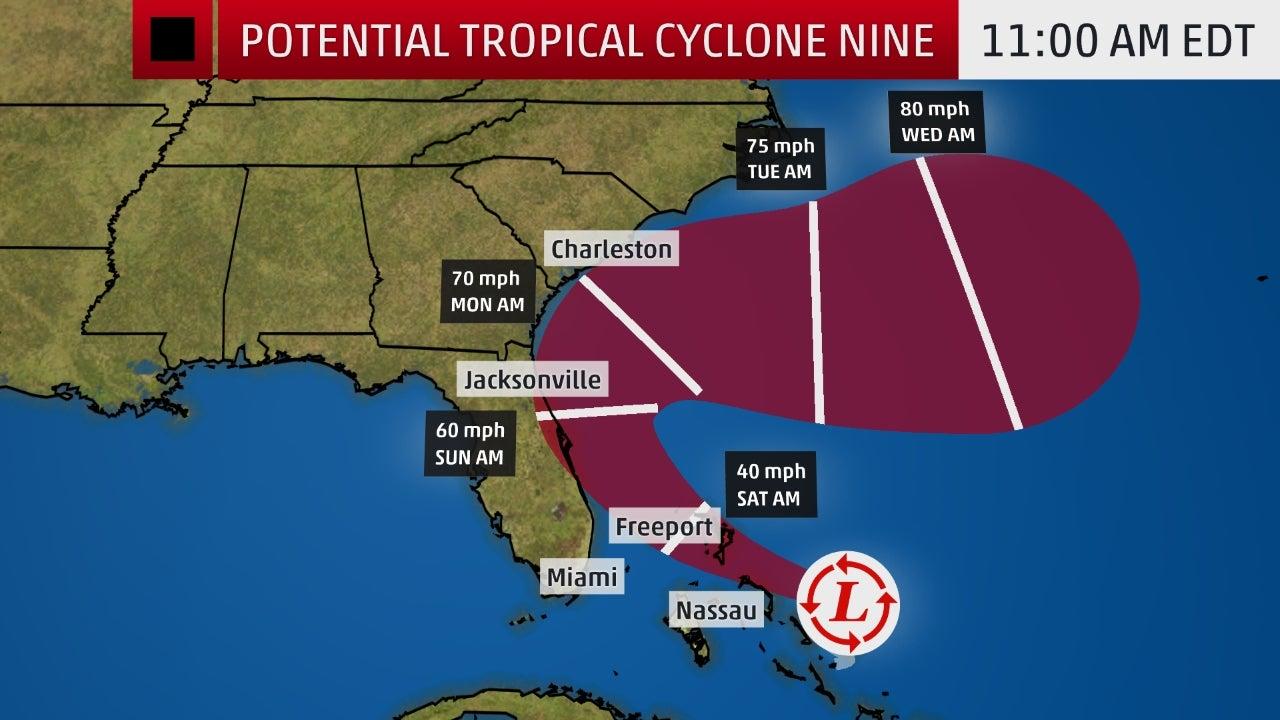
It will earn the name Humberto if it does attain tropical storm status. This system is expected to become a hurricane early next week when it is off the Southeast coast.
Projected Path
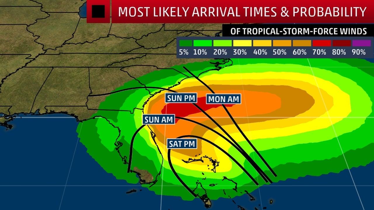
Tropical-storm-force winds are forecast to arrive in the tropical storm warning area in the northwestern Bahamas by late Friday, according to the NHC.
Those 39-plus-mph winds are then possible in the tropical storm watch area on Florida’s east coast by Saturday night.
Most Likely Arrival Times and Probability of Tropical-Storm-Force Winds
Where this system tracks has become yet another challenging forecast, in large part because the center of the disturbance is very poorly defined, so the computer forecast models don’t have much to latch onto in their analyses.
There are two basic scenarios:
1. If a tropical depression or storm forms sooner and stronger, it would favor a track farther east, over parts of the Bahamas and near Florida’s east coast, steered by upper-level south to southeasterly winds.
2. If a tropical depression or storm forms later and weaker, it would favor a track more toward the west-northwest, eventually into the Gulf of Mexico.
There has been a trend farther east and north – basically, the first scenario – suggesting a track near the Bahamas, Florida and the southeastern U.S. coast is possible this weekend into early next week. It could track far enough offshore for there to be limited impacts to the U.S.
Satellite data suggests that this system could be organizing a bit farther east, which could result in another shift in the forecast track to the right.
The bottom line is that the forecast is highly uncertain. Interests from the northern Gulf Coast to Florida, the Bahamas, Georgia and the Carolinas should monitor the latest forecast for this system closely.
Spaghetti Models
Early next week, an eastward moving trough is expected to force this system away from the East Coast into the Atlantic.
Heavy Rain Threat
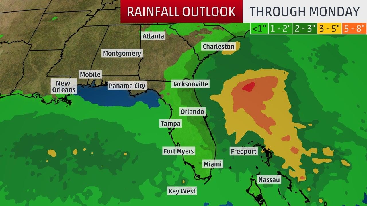
Periods of gusty winds and locally heavy rain can be expected the next few days in the Bahamas and Florida. This includes areas ravaged by Hurricane Dorian in the northwestern Bahamas.
In general, the heaviest rain should fall along and to the east of the center of this system. As mentioned earlier, the track of this system is highly uncertain at this time.
The NHC says 2 to 4 inches of rain is expected over the Bahamas, with locally up to 6 inches possible. Along the southeastern U.S. coast from central Florida through southeastern Georgia, 2 to 4 inches of rain is predicted.
Localized flash flooding is possible in areas where bands of rain stall or persist over an area.
Rainfall Outlook
Higher surf and rip currents may build along the northern and eastern Gulf Coast, as well as the Atlantic beaches of Florida, Georgia and the Carolinas, into this weekend.
An isolated waterspout or tornado is also possible in Florida or the Bahamas into this weekend.
Tyler Durden
Fri, 09/13/2019 – 12:15
via ZeroHedge News https://ift.tt/2ZVMcyg Tyler Durden
