Winter Storm To Blast Northeast Through Saturday
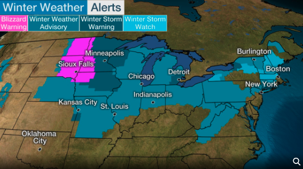
A powerful winter storm is dumping snow and ice across the Midwest and will arrive in the Northeast on Saturday, reported The Weather Channel.
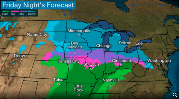
By Friday afternoon, snow will be seen from eastern Dakotas and Minnesota to as far as Wisconsin and Illinois.
There’s an elevated risk that Minneapolis-St. Paul and Chicago could see accumulating snow that would impact rush-hour commute this evening.
Sleet and freezing rain are expected for parts of Kansas and Missouri through Friday afternoon, extending into southern Nebraska, southern Iowa, and southern Illinois. Much of the wintery precipitation should change over to rain by evening.
Accumulating snow and blizzard conditions are possible Friday evening for parts of eastern Dakotas, western Minnesota and northwest Iowa.
By midnight, snow will push into the Great Lakes from Wisconsin to western Pennsylvania. Sleet and freezing could be seen across parts of Ohio to West Virginia.
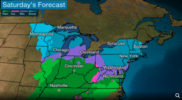
Snow is expected to arrive in the Northeast by early Saturday and move up the Interstate 95 corridor from the Baltimore–Washington metropolitan area to Boston throughout the day. A changeover to a wintery mix then to rain will be seen for coastal areas along the Interstate 95 region.
Accumulating snow will be seen in the interior Northeast throughout Saturday.
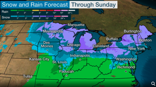
Preliminary estimates show up to 6 inches could be seen for the Upper Midwest across the Great Lakes to upstate New York and northern New England through Saturday night.
Major metros along the Interstate 95 corridor of the Northeast could see 1 to 3 inches, but a transition to rain could lessen the totals.
Tyler Durden
Fri, 01/17/2020 – 15:50
via ZeroHedge News https://ift.tt/2TACHR0 Tyler Durden


