One month after one of the most powerful storms on record pummeled the Plains and Midwest, another storm of similar strength has been forecasted to strike the same region this week.
“Another strong storm is poised to impact the central U.S. from Colorado to the Great Lakes mid-to-late week this week, with strong winds, and heavy precipitation” reported Meteorologist and owner of Empire Weather, Ed Vallee.
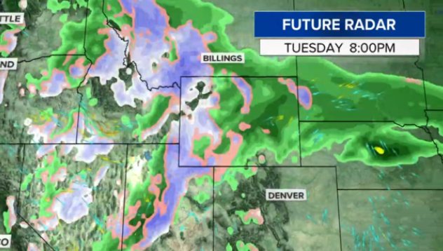
“While likely not a “bomb” (requires a 24mb drop in 24 hours or less), this will be another very strong storm with significant impacts. Rain and snow will break out across South Dakota, Nebraska, and Iowa Tuesday night, and expand in coverage across the central Plains and Midwest into Wednesday. As this storm deepens, winds will be strong, gusting 40-60 mph across the Plains, leading to strong wind generation. Alternatively, heavy rain and snow will impact SD, northern NE, and MN with some areas seeing up to 2 feet of accumulation. Data points to total liquid falling from this storm ranging from 2-4″, with locally higher amounts. Regardless of exact numbers, this region is moisture laden due to heavy winter rain and snow, and this additional moisture will lead to catastrophic flooding in the Upper Midwest. This will continue to promote disruptions to planting processes in the central and southern U.S., and likely lead to delays further north as we head deeper into the Spring,” Vallee added.
Vallee explains the probabilities of the storm developing into a “bomb cyclone” (an area of low pressure that drops 24 millibars in 24 hours) are low. However, some weather models are showing the storm is on the brink of becoming one. Either way, this storm is expected to unleash severe weather in the next 12 to 48 hours.
The WPC forecast for Thursday morning implies that April low pressure records are possible in the central Plains & Midwest. pic.twitter.com/kb2eyOrzT5
— David Roth (@DRmetwatch) April 7, 2019
The storm is currently developing in the Rockies Tuesday, where it will quickly intensify and bring blizzard conditions to the Plains on Wednesday.
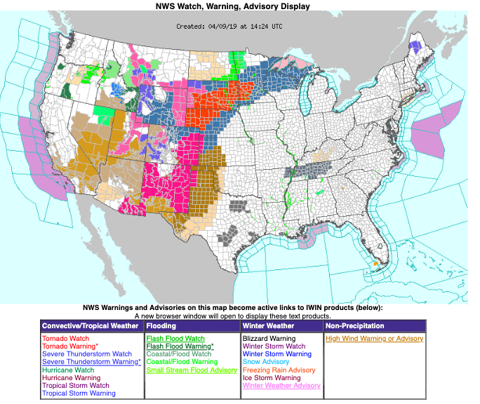
Blizzard and winter storm warnings are posted for Wyoming, South Dakota, Nebraska, and Minnesota. Arctic air will collide with the storm, could unleash up to 20 inches of snow with wind gusts of 45-50 mph in some parts.
Tuesday night temperatures in the Plains will drop 40 degrees in less than 12 hours.
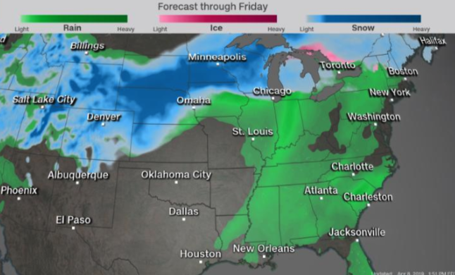
By Thursday, the storm will dump heavy snow on the Midwest. Places like Minneapolis could see close to a foot.
In the warmer air to the south, heavy rains and high winds could create flooding concerns for Kansas and Nebraska. On Thursday, the storm will cross into Illinois, Indiana, Kentucky, and Tennessee. Tornadoes are likely in some parts.
Even if Vallee is right and this storm doesn’t become a bomb cyclone, it’s still expected to unleash hazardous weather affecting tens of millions of people while further adding to the woes of farmers in the region, who as we reported yesterday, face $100 millions in losses on destroyed crops.
via ZeroHedge News http://bit.ly/2OZnbcS Tyler Durden


