“Bomb Cyclone” Looms Again As NorthEast Storm Intensifies Through Weekend
A “bomb cyclone” could be headed for the Northeast this weekend as a powerful storm tracks up the coast on Saturday.
Severe thunderstorms rolled through parts of North Florida on Saturday morning. The National Weather Service (NWS) in Jacksonville announced tornado warnings for parts of Putnam and St. Johns counties. There were reports that a tornado touched down near St. Augustine.
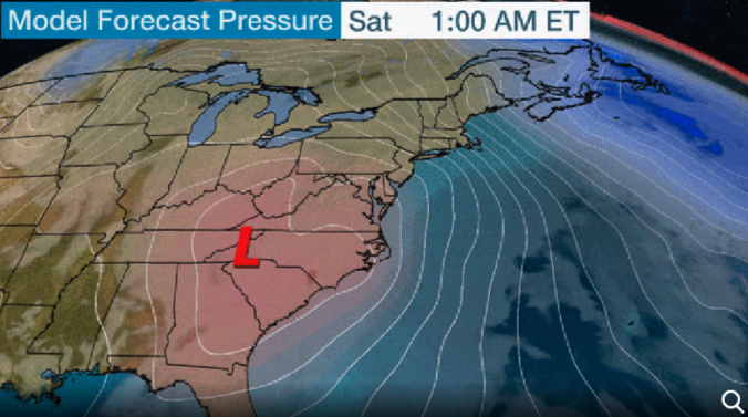
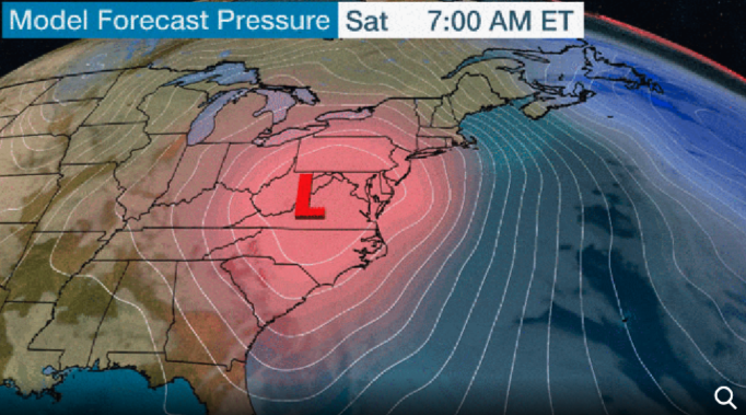
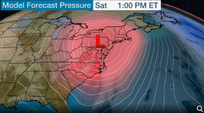
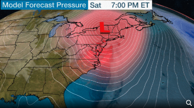
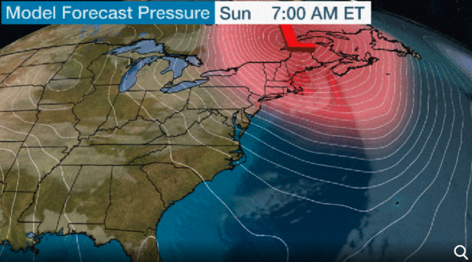
The Weather Channel says forecast models suggest the low-pressure system will move up the Eastern Seaboard through the weekend. The storm is expected to intensify and race up to eastern Canada by Sunday morning.
Models indicate the storm could be classified as a bombogenesis, a weather term that describes how a storm’s central pressures falls 24 millibars within 24 hours, by late Saturday.
The storm will be a rain and wind event for the Northeast on Saturday and early Sunday. The heaviest rain will be seen on Saturday.
Rain is expected to change into heavy wet snow in the eastern Great Lakes and the Appalachians on Saturday evening.
During the overnight, snow will likely be seen in parts of central and Upstate New York into the Green and the White Mountains of northern New England.
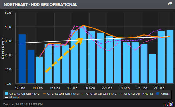
Cold air will enter the Northeast as the storm exits early Sunday. Notice how heating degree days index for the Northeast steadily increases from this weekend well into the end of next week. This could also increase natgas demand in the region as well.
NWS has issued weather alerts for eastern Pennsylvania, northern New Jersey, and New England for flash flooding. Maine could see 1 to 2 inches of rain in the overnight and through early Sunday morning.
Regions from the Appalachians to northern New England are forecasted to see at least 6 inches of snow.
The storm is expected to be defined as a bomb cyclone sometime on Saturday, and this means as the storm intensifies, it could produce 40 to 50 mph winds for mid-Atlantic states to New England.
Given the already wet conditions in the Northeast for the last several weeks, this could cause downed trees and power outages.
High winds will continue through Sunday into Monday for parts of New York and New England.
Tyler Durden
Sat, 12/14/2019 – 13:00
via ZeroHedge News https://ift.tt/34hXt9v Tyler Durden
