Powerful Winter Storm To Impact Millions Across Midwest And Northeast Through Weekend
A powerful winter storm will track through the Plains, Midwest, and Northeast late in the week and through the weekend, dumping, in some areas, heavy snow and a mix of wintery precipitation, reported The Weather Channel.
The storm will spread snow and rain across the West through Thursday. By Friday, snow, ice, and rain will be seen in the Midwest and Great Lakes.
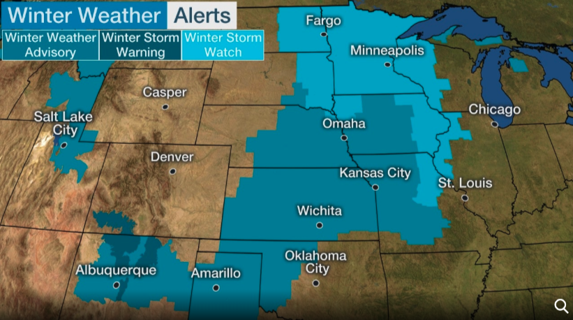
Winter storm watches have already been issued for much of the Midwest and Mississippi Valley from eastern Dakotas and Minnesota to Missouri.
Heavy snow and ice storms could develop late Thursday in parts of the Plains. Areas that could see the worst impact are from the panhandle of Texas and Oklahoma into parts of Kansas, western Missouri, western Iowa, Nebraska, southwestern Minnesota and eastern South Dakota.
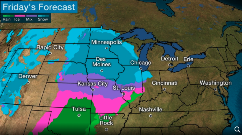
Friday could be a wintery mess for the Midwest and Great Lakes areas. Weather-related accidents could flare up across the Interstate 70 from Kansas to Ohio.
Snow is expected from eastern Dakotas to the upper Mississippi Valley and Great Lakes on Friday. Southern parts of the Great Lakes could see snow change to rain by Friday evening.
Commuters in Kansas City and Omaha, Nebraska, could experience severe driving conditions on Friday because of accumulating snow. Evening commuters in Chicago, Milwaukee, and Minneapolis-St. Paul could also see dangerous driving conditions.
The storm will push through the Rust Belt and the Appalachian Mountains late Friday.
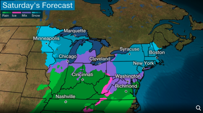
The system is expected to arrive in the Mid-Atlantic and Northeast on early Saturday. Areas around Interstate 95 corridor from the Baltimore–Washington metropolitan area to coastal southern New England will see a mix of wintery precipitation with the possible changeover to rain.
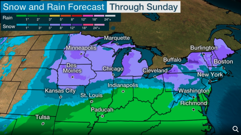
Snowfall projections for the upper Mississippi Valley into parts of the Great Lakes and interior Northeast could exceed 6 inches. There’s a possibility of accumulating snow along some parts of the Interstate 95 corridor of the Northeast. However, it’s still too early to give projections of snow totals in the Mid-Atlantic and Northeast because of the uncertainty surrounding the location of the 32-degree weather line.
Tyler Durden
Thu, 01/16/2020 – 10:25
via ZeroHedge News https://ift.tt/38950dd Tyler Durden


