Tropical Storm Sally To Strengthen Into Hurricane With Crosshairs On Gulf Coast States
Tyler Durden
Mon, 09/14/2020 – 09:40
Tropical Storm Sally is moving away from Florida as it will strengthen into a hurricane Monday afternoon. The storm is expected to make landfall along portions of the northern Gulf Coast on Tuesday.
Sally is moving west-northwest toward Mississippi and Louisiana on Monday morning and could strengthen into a category one storm by the afternoon. The National Hurricane Center (NHC) said the storm could bring life-threatening storm surge, hurricane winds, and heavy rains to certain Gulf Coast states.
“Tropical Storm Sally expected to become a hurricane on Monday and move very slowly when it nears the northern Gulf coast. New Hurricane and Storm Surge Warnings have been issued.
“Outer rain bands approaching the Northern Gulf Coast. Sally likely to produce Life-threatening storm surge, hurricane-force winds, and flash flooding along portions of the Northern Gulf Coast starting late today,” the NHC said.
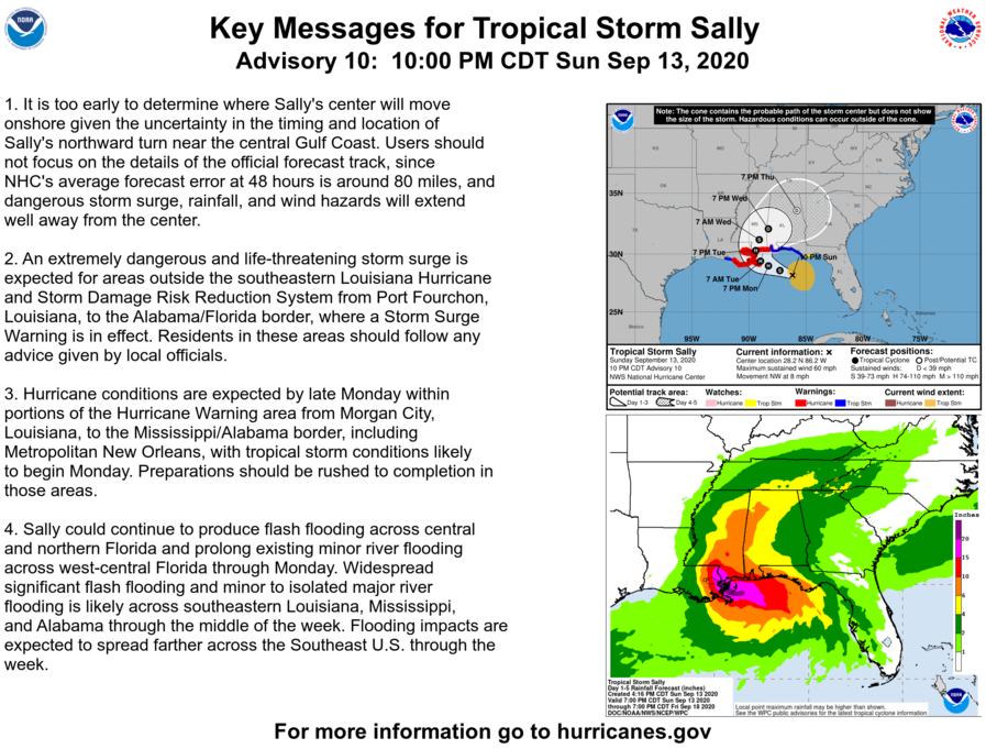
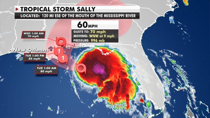
As of early Monday morning, Sally is about 175 miles southeast of Biloxi, Mississippi, with maximum sustained winds around 60 mph.
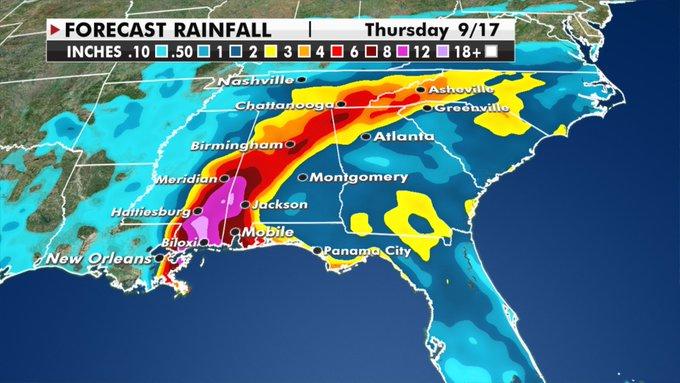
While Sally is not expected to strengthen into a major wind event like Hurricane Laura a couple of weeks ago – the storm could bring an enormous amount of rain to the Gulf Coast. Here are some of the latest rainfall estimates through Thursday.
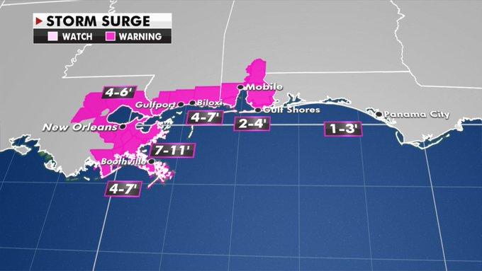
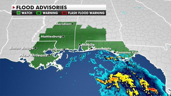
Storm surge warnings have been issued for Gulf Coast states.
Flooding is another concern.
Behind Sally, there’s a lot of activity in the Atlantic Basin.
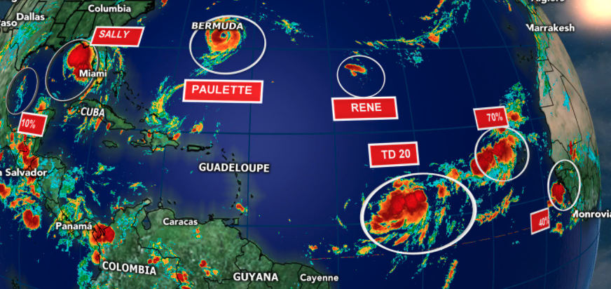
Meteorologist Philip Klotzbach says the “2020 Atlantic hurricane season has already generated 54 named storm days. Only five years in satellite era (since 1966) have produced more named storm days through September 13: 1995, 2005, 2008, 2011, and 2012.”
The 2020 Atlantic #hurricane season has already generated 54 named storm days. Only 5 years in satellite era (since 1966) have produced more named storm days through September 13: 1995, 2005, 2008, 2011 and 2012. #Paulette #Sally pic.twitter.com/aLUq22woXR
— Philip Klotzbach (@philklotzbach) September 14, 2020
Readers may recall, as early as August, we suggested La Nina was responsible for the super active hurricane season.
Then last Thursday (Sept. 10), the U.S. Climate Prediction Center confirmed La Nina in the Northern Hemisphere was formed in August, which confirmed our suspicions.
Klotzbach is warning this year’s hurricane season could remain very active through October.
“Typically, what ends Atlantic hurricane seasons is that vertical wind shear gets too strong,” Klotzbach told CNN. “So, El Niño, via its impacts on vertical wind shear, has a stronger impact on September and especially October hurricanes than it does on August hurricanes. With La Niña, vertical wind shear tends to be lower, and consequently, we end up with more active late seasons.
With more disturbances swirling in the Atlantic Basin, we suspect more storms could be headed for the U.S.
via ZeroHedge News https://ift.tt/2GTYlep Tyler Durden