“Powerful” Hurricane Teddy Strengthens To Cat 4 With Canada In Crosshairs; Tropical Depression 22 Forms In Gulf
Tyler Durden
Fri, 09/18/2020 – 08:35
The National Hurricane Center (NHC) is closely monitoring “powerful” Hurricane Teddy as it continues to churn in the Atlantic Ocean and could make landfall in Canada early next week.
As of 0500 ET Friday, Teddy is generating 130 mph winds (Category 4) while moving northwest at 12 mph and located about 900 miles southeast of Bermuda. The system is expected to make landfall near Nova Scotia, Canada, as a Category 2, on Tuesday/Wednesday.
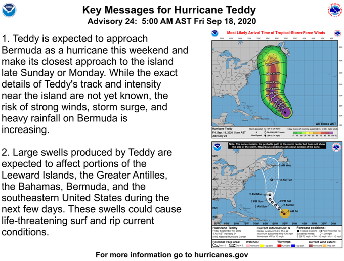
Chief meteorologist Cindy Day of SaltWire Network, a Canadian newspaper, said Teddy “would come into Canadian waters late Monday night, and we’d start to get impacted Tuesday afternoon in Nova Scotia, Wednesday in Newfoundland.”
“It’s still quite a distance out and a lot of things could happen between now and then.
“It looks like it’s going to intensify to a 4 maybe by the end of the afternoon (Friday), so it’s a powerful system. The danger with this system is that it’s not tracking over or close to land. When systems do that, the outer bands … when they start to brush up against coastline or land, it weakens the storm system. There’s no land around. It’s out in the mid-Atlantic and it’s just churning and the sea surface temperatures are warmer than normal. So right now, there’s nothing to weaken this system,” said Day.
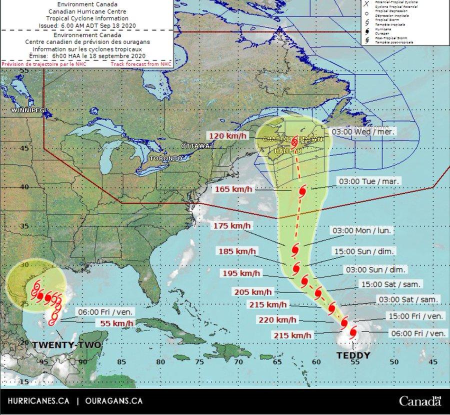
Day said some weather models have Teddy taking a northwest turn before heading for Nova Scotia, indicating landfall could be between Yarmouth and Halifax.
“That’s how I see the path unfolding, but again a little shift in the system over the Labrador Sea and the high coming in from Quebec and that could get squeezed further to the left or further to right. It looks like there’s going to be some impact, but how significant and where landfall is going to be – it’s a little bit too soon to say just yet.”
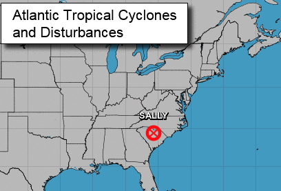
As Teddy churns in the Atlantic on Friday, the remnants of Hurricane Sally are moving offshore from the Southeastern/ Mid-Atlantic region.
In another NHC update, Tropical Depression 22 could strengthen into a hurricane over the weekend with models forecasting a South Texas strike.

Readers may recall the reason behind the super active hurricane season is La Nina.

All eyes on Hurricane Teddy and Tropical Depression 22 this weekend.
via ZeroHedge News https://ift.tt/35NEiJe Tyler Durden