Authored by William Craddick, via Disobedient Media,
Since the February 2019 Hanoi Summit, media outlets have been awash with inaccurately interpreted satellite images of North Korean installations at locations such as the Sohae Satellite Launching Station and the Sanumdong Research and Development Facility. The United Nations Panel of Experts has also turned to satellite footage as a means of proving sanctions evasion but likewise engaged in misrepresentation when trying to pin violations onto the Democratic People’s Republic of Korea (DPRK). So where are North Korea’s sanctions violations generally occurring?
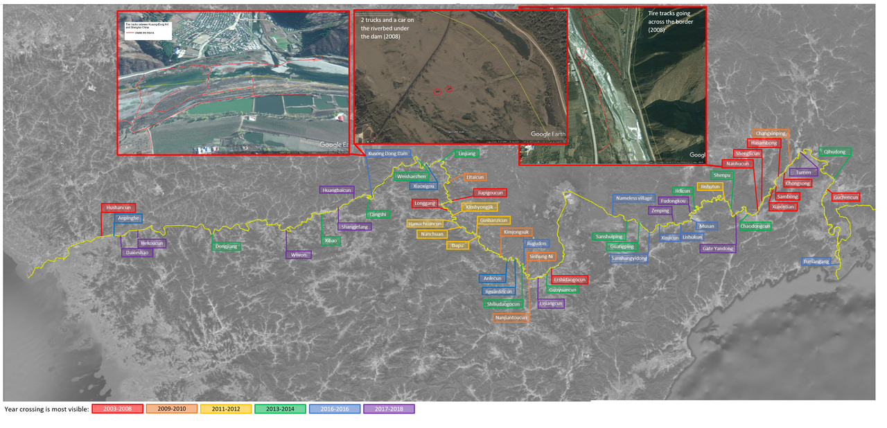
While much of the media coverage tends to be manipulated with the intention of aggravating tensions between North Korea and the outside world, real evidence of smuggling along the DPRK’s northern border can easily be identified even by members of the public. Disobedient Media has been able to pinpoint a number locations where cross-border smuggling was occurring using Google Earth. This kind of activity not only violates sanctions, but also poses a security risk to the DPRK since it reduces their ability to control who can enter and exit the country.

Combatting smuggling has recently become a priority for not only North Korea but also their neighbors as the United States and DPRK continue to negotiate denuclearization. On April 11, 2019, President Donald Trump thanked China and Russia for helping “more than people think” with combatting smuggling along the border with North Korea while meeting with South Korean President Moon Jae-in. Just days before on April 8, South China Morning Post revealed that a Chinese border patrol unit in Tonghua, Jilin province had contracted with China Mobile to build the country’s first 5G checkpoint at Yunfeng Reservoir along the border with North Korea.

On March 22, Radio Free Asia reported that North Korea had arrested the commander of one of the country’s defense regiments in Hyesan, Ryanggang province. Residents reported confusion about the DPRK’s sudden decision to crack down on smuggling in the region which had previously occurred with what is said to be tacit government approval as smugglers befriended local officials. The push represents a new resolve from countries on both sides of the border to crack down on sanctions evasion as the peace process has gained traction.
Using satellite imagery made available through Google, it is possible to identify a large number areas where illegal border crossing is occurring on a pervasive scale. Authorities in China, Russia and North Korea will continue to have their work cut out for them.
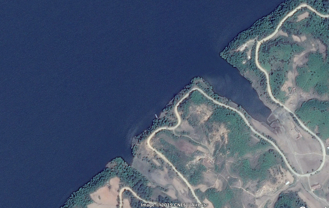
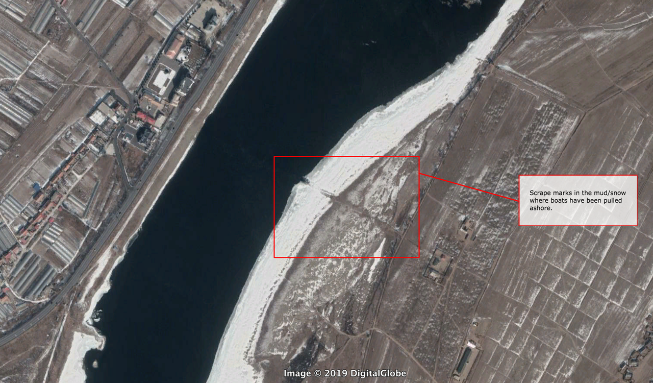
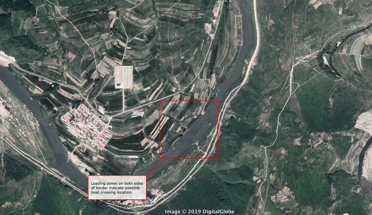
One kind of smuggling occurs by using boats to cross North Korea’s border along the Yalu and Tumen Rivers. A selection of photos is provided below:

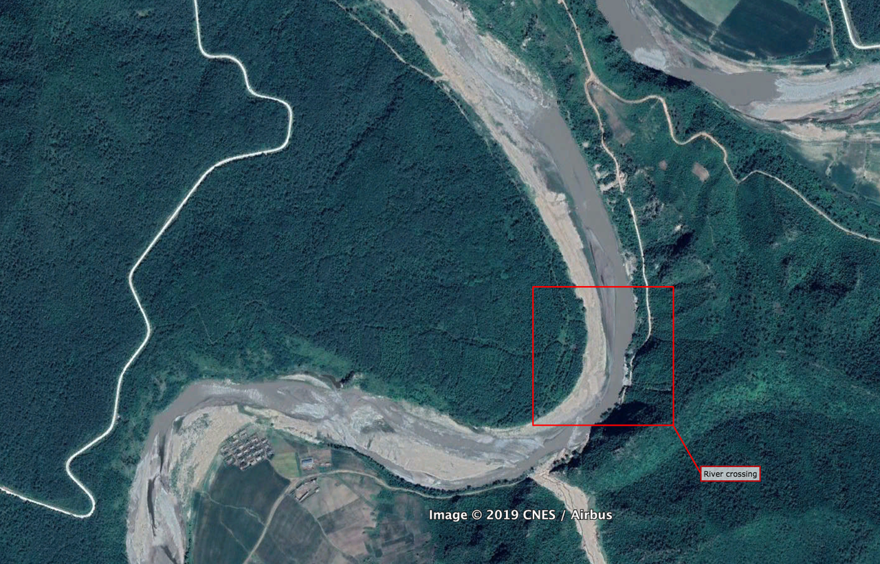
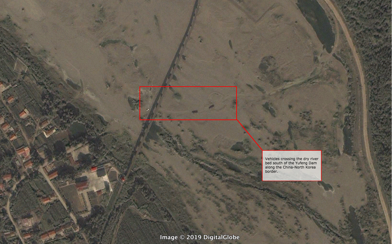
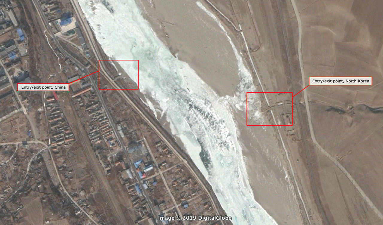
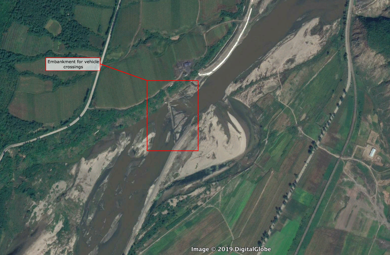
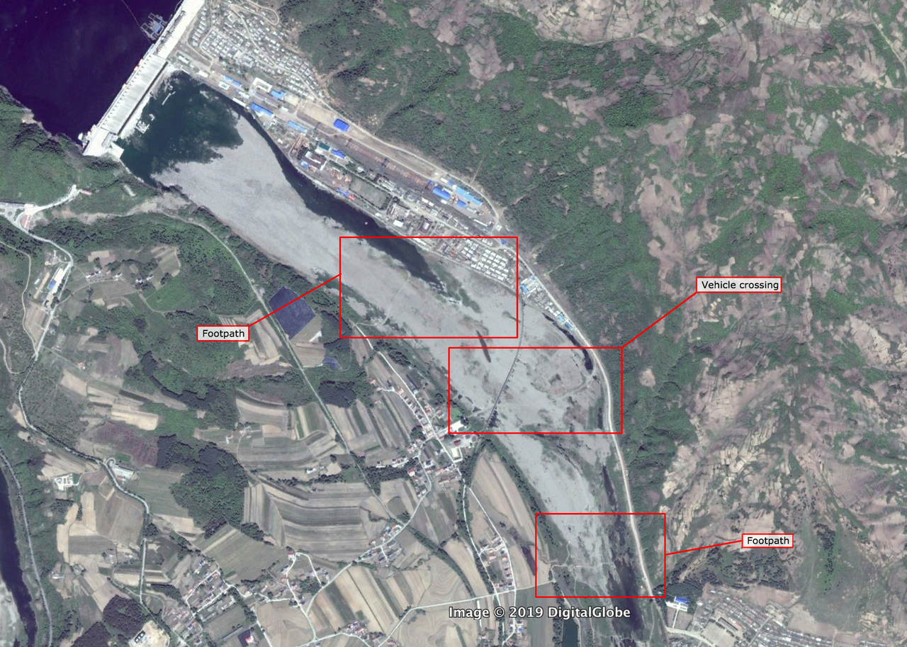
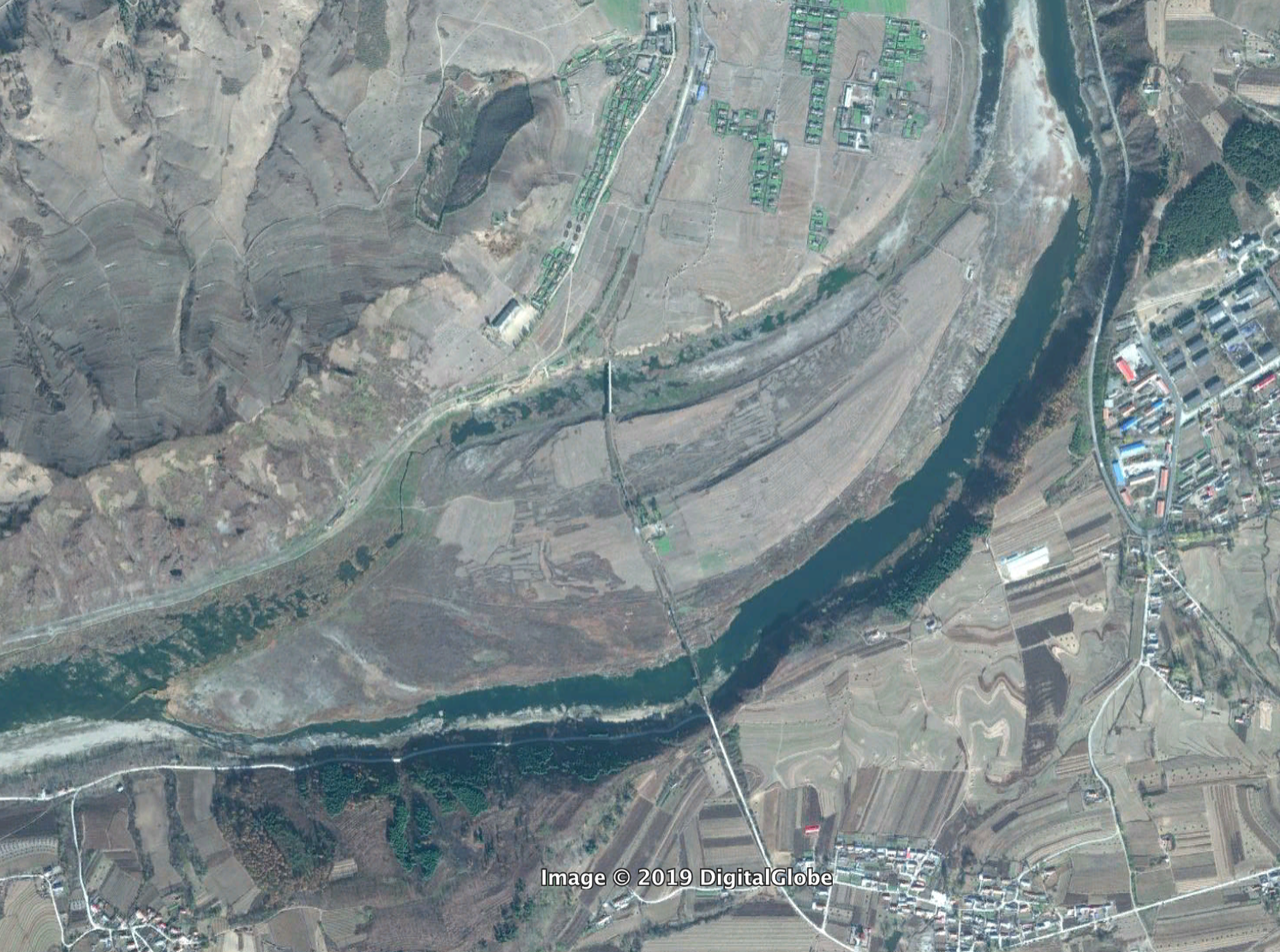
Another common method is vehicle and foot crossings across areas of the border where the riverbed has dried sufficiently or where enough ice has formed in the winter to allow for easy access. Examples of this kind of activity can be seen here:
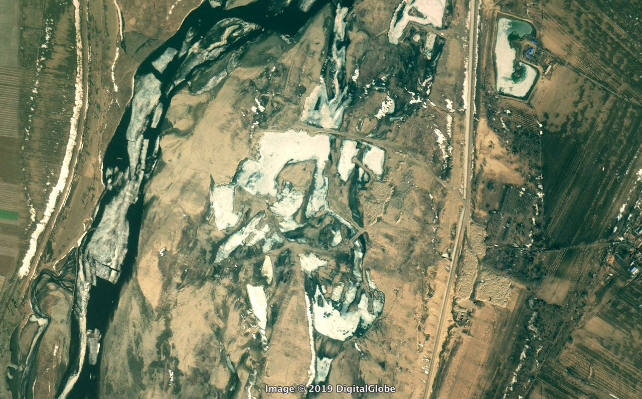
The area south of the Yunfeng Dam is a hotbed for cross border smuggling. Satellite imagery appears to show that the dam may not have been opened to let out a significant amount of water since 2013. This has allowed the Yalu River’s bed to run dry, making it idea for border crossings but likely hurting water supplies downstream and causing environmental damage.

The fight against cross border smuggling has only just begun as North Korea begins to take new steps to prove its determination to seek a peaceful resolution to their 66 year-old conflict with the US and South Korea.
via ZeroHedge News http://bit.ly/2UqAKmK Tyler Durden