China Launches High-Res Satellite To Monitor Belt And Road Projects
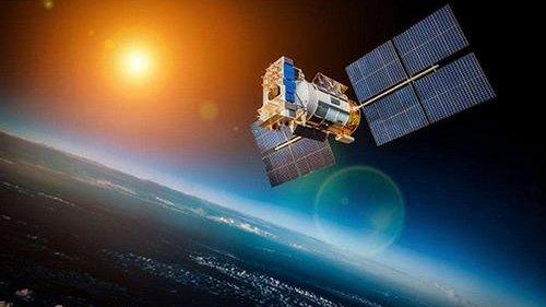
China on Sunday launched a new high-resolution remote sensing satellite, called the Gaofen-7, which will be used to monitor Belt and Road Initiative (BRI) infrastructure projects, reported Xinhua.
The Gaofen-7 was launched on top of a Long March-4B rocket on Sunday at the Taiyuan Satellite Launch Centre in northern China.
Video of Long March 4B carrier rocket sending Gaofen 7 high-resolution Earth-observation #satellite into space on Sunday morning from the Taiyuan Satellite Launch Center in N China’s Shanxi. pic.twitter.com/Cq1DuA3mWL
— China Science (@PDChinaScience) November 4, 2019
China Central Television (CCTV), citing China National Space Administration (CNSA), said the optical surveying and mapping satellite would mostly be used for urban planning and statistical research, which will allow China to reduce its dependence on foreign satellites.
China’s Gaofen-7 Earth observation satellite was successfully sent into space on Sunday.
The satellite is a camera system composed of two line-scan cameras to capture 3D images of the Earth, and a laser altimeter to measure height more precisely. pic.twitter.com/QVsPTFhnz6— China Focus (@China__Focus) November 4, 2019
The Ministry of Natural Resources, the Ministry of Housing, and Urban-Rural Development and the National Bureau of Statistics will be the three most active users of Gaofen-7.
According to CNSA, the Gaofen series of satellites will support a surveillance network above Earth that will monitor the atmosphere, the ground, and oceans on a 24-hour basis.
The Gaofen project began in 2010. The first satellite was launched in 2013, and five more have been launched since (Gaofen satellite list via Xinhua):
- Gaofen-1, launched into space in April 2013, is a high-resolution observation satellite.
- Gaofen-2, sent into space in August 2014, is accurate to 0.8 meters in full color and can collect multispectral images of objects greater than 3.2 meters in length.
- Gaofen-4, launched in late 2015, is China’s first geosynchronous orbit high-definition optical imaging satellite.
- Gaofen-3, launched in August 2016, is China’s first synthetic aperture radar imaging satellite.
- Gaofen-5, launched in May 2018, has the highest spectral resolution of China’s remote sensing satellites.
- Gaofen-6, launched in June 2018, has a similar function to that of Gaofen-1, but with better cameras, and its high-resolution images can cover a large area of the earth.
The launch of Gaofen-1 coincides with the start date of BRI infrastructure development and investment projects.
In the last six years, China has expanded BRI projects in 152 countries across Asia, Europe, Africa, the Middle East, and the Americas.
It seems like China has just built a giant surveillance network of satellites that will monitor its global infrastructure projects.
Tyler Durden
Tue, 11/05/2019 – 23:05
via ZeroHedge News https://ift.tt/2rk0A3b Tyler Durden