Record Cold And Snow Pound Northern US Aiding Firefighters
Tyler Durden
Mon, 10/26/2020 – 09:35
Authored by Mike Shedlock via MishTalk,
Colorado is getting some help from the weather. California is not as lucky.
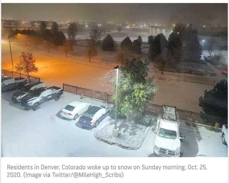
Snow Blankets North-Central
Accuweather reports Record-Setting Cold Over North-Central US.
It’s beginning to look a lot like winter across parts of the north-central United States as a snowstorm targets millions of Americans. The wintry mix is spreading to areas much farther south, including some that typically don’t pick up snow until much later in the season.
“Cold air will continue to steadily march southward through the early part of the week with many areas seeing records challenged once again,” AccuWeather Meteorologist Maxwell Gawryla said. “As significantly below-average temperatures remain in place, many more records will likely be broken through the first half of the week.”
With this storm coming on the heels of recent winterlike weather that shattered a 115-year-old snowfall record in the Twin Cities, residents across the Plains and Upper Midwest may check their calendars twice to make sure it’s still October.
With this storm coming on the heels of recent winterlike weather that shattered a 115-year-old snowfall record in the Twin Cities, residents across the Plains and Upper Midwest may check their calendars twice to make sure it’s still October.
Billings, Montana, fell to 16 degrees F on Saturday morning, breaking the previous record of 19 degrees for that day set in 1976. On Friday, Idaho Fall, Idaho, fell to 13 with a previous record of 16 set in 1980 and Casper, Wyoming, broke their previous daily record of 11 in 1984 with -5.
Spokane, Washington, shattered its snowfall record for that day on Saturday with nearly 8 inches of snow, while the previous record was 0.2 inches in 1957.
Portions of the drought-stricken Southwest may also get their first bouts of precipitation in weeks as the storm continues to dive southward by next Monday. Residents of Flagstaff, Arizona, could even see snowflakes fly early next week.
Snow Aids Colorado Firefighters But Brings News Challenges

In Colorado, Fire Management Teams Get Snow, Colds Temps They Were Hoping For, But That Brings Its Own Challenges.
The Cameron Peak fire is the first to see snowfall this morning, with an estimated three-five inches in the northernmost parts of the blaze, according to the incident management team.
“Lighter amounts as you go further to the South, the Southern portions of the fire, generally around two to four inches, so far,” said incident meteorologist Dan Byrd in a Facebook update. “Temperatures overnight are going to be very cold across the entire fire. Most of the fire will see conditions below zero tonight, probably around five to seven below zero, and then single-digit temperatures in the lower elevation.”
As of this morning, temperatures in the East Troublesome Fire area, which has grown to 192,560 acres, were still in the low 40s, Meteorologist Byrd said. The fire made a run towards Estes Park on Saturday. By late in the day it had burned into the Moraine Park area of Rocky Mountain National Park, but it had not reached Bear Lake Road.
The fires could see between 10-18 inches of snow in total by Monday. There is expected to be “very limited fire behavior” over the next 24 hours for all four fires thanks to the snowstorm, according to the Incident Information System.
“We’ll take advantage of the weather while we can,” East Troublesome Fire incident commander Noel Livingston said, adding that planes were not able to fly and make bucket drops due to wind conditions on Saturday. He anticipated being able to do more today. “I anticipate a productive day.”
What About California?
That’s the mostly good news about Colorado.
California, unfortunately, is another matter.
The Fresno Bee reports Creek Fire updates, Oct. 25: ‘Extreme fire activity is possible,’ power outages planned
Critical fire weather conditions are expected in the Creek Fire region and beyond Sunday evening through Tuesday evening due to strong easterly winds and low humidity, prompting a red flag warning from the National Weather Service.
The warning is in effect from 5 p.m. Sunday to 5 p.m. Tuesday and covers the central and southern Sierra Nevada and foothills.
“Extreme fire activity is possible,” Creek Fire officials said, “and if there is a new start or the fire escapes containment lines you can expect rapid rates of spread.”
Red Flag Warnings
Red Flag Warning now in effect for the Sierra Nevada foothills and mountains as well as Kern County foothills, mountains, and desert areas from Sunday evening until Tuesday evening. This replaces the Fire Weather Watch that was in place. More info here: https://t.co/2m2ztrJy43 pic.twitter.com/uUkFto5KN3
— NWS Hanford (@NWSHanford) October 24, 2020
WEATHER: A major offshore wind event is coming to California and extreme southern Oregon. Red flag warnings and fire weather alerts have been posted for large parts of the state including, San Francisco and Los Angeles. https://t.co/30ESKg5scF
— ABC News (@ABC) October 24, 2020
The snow is helping Colorado and Idaho but California only got the winds.
via ZeroHedge News https://ift.tt/31IuDAQ Tyler Durden