Another Hurricane Season Is Underway: What To Know
Authored by T.J.Muscaro via The Epoch Times,
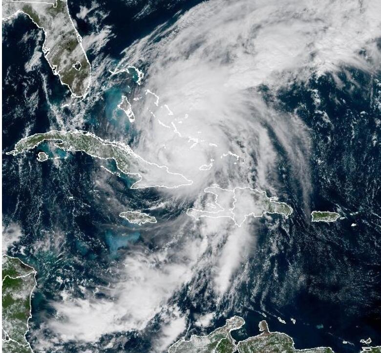
June 1 marked the start of yet another hurricane season for the Atlantic Ocean, Caribbean Sea, and Gulf of America.
The National Oceanic and Atmospheric Administration (NOAA) is forecasting a lower-than-average number of named storms between now and Nov. 30 thanks to “El Niño.” This is a recurring weather event known to lower the jet stream over the southeastern United States and create an environment in the Gulf and Atlantic less friendly to hurricane development.
But every storm that ultimately manifests will be monitored with the help of a new array of AI and drone technologies.
Commerce Secretary Howard Lutnick praised the adoption of what he called “the most advanced forecast modeling and hurricane tracking technologies,” promising it would allow NOAA to provide “real-time storm forecasts and warnings” with “the most accurate information possible.”
However, the government’s weather experts made clear that advanced forecasting capabilities and a lower storm count do not signal any decrease in potential damages.
“Although El Niño’s impact in the Atlantic Basin can often suppress hurricane development, there is still uncertainty in how each season will unfold,” said NOAA’s National Weather Service Director Ken Graham. “That is why it’s essential to review your hurricane preparedness plan now. It only takes one storm to make for a very bad season.”
Forecast: 8-14 Named Storms
Between June 1 and Nov. 30, NOAA predicted that eight to 14 named storms—well-formed cyclones with sustained winds of 39 mph or higher—will form in the Atlantic Basin. Of that total, three to six are forecast to reach hurricane status (cyclones with sustained winds of 74 mph or greater), with one to three expected to become major hurricanes (storms labeled Category 3-5 with sustained winds reaching 111 mph or more).
An “average” hurricane season produces 14 named storms, with seven of those being hurricanes and three reaching major hurricane status.
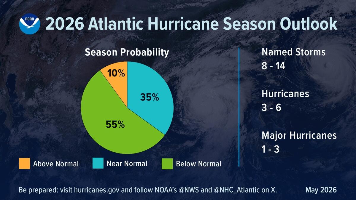
Hurricane season probabilities from NOAA’s 2026 Atlantic Hurricane Season Outlook. Courtesy of NOAA
The forecast reflects the return of El Niño, but NOAA also noted that warmer-than-average waters and weaker-than-average trade winds are anticipated. This is a combination favorable for storm development.
The 2025 hurricane season produced 13 named storms: four tropical storms, five hurricanes, and four major hurricanes. It was also the first time in 10 years that no hurricane made landfall in the United States.
But the annual devastation still made its mark as Hurricane Melissa ripped across Jamaica with maximum sustained winds of 185 mph. It was one of the most powerful hurricanes on record to make landfall, leaving as much as 70 percent of the western half of the island uninhabitable.
NOAA advises all citizens living in hurricane-vulnerable areas to consult its online safety and preparation guides.
AI, Drone Forecasting Tools
NOAA and its National Hurricane Center will unleash a swath of new data-collecting technologies this hurricane season.
Drones built for air and sea by industry partners such as Saildrone and Black Swift will venture into corners of an active hurricane that are too dangerous for crewed missions.
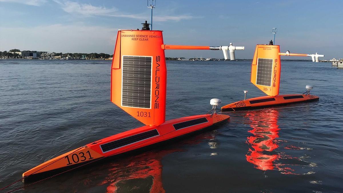
Two Saildrone Explorers launched during the 2021 hurricane season from Jacksonville, Fla. Courtesy of Saildrone
More than two dozen surface vehicles will collect data on wind speeds, wave heights, air temperature and pressure, as well as ocean temperature and salinity as a storm passes overhead. Other data-collecting tools will be used to study subsurface ocean temperatures and salinity and their relation to hurricane development.
Meanwhile, aerial drones will work side by side with the crewed Hurricane Hunter flights. They will collect data from corners of the cyclone too dangerous for people to fly through, including ultra-low altitudes where the storms meet the sea. NOAA said the drones were expected to improve the accuracy of its Hurricane Analysis and Forecast System by as much as 10 percent.
NOAA’s Atlantic Oceanic and Meteorological Laboratory is also using machine learning to improve data collection capabilities of the Hurricane Hunter planes’ tail doppler radar by 25 percent.
Upgraded forecast prediction models will also be unveiled this season. By using AI tools, these new models will better indicate a storm’s predicted intensity.
“Instead of replacing traditional models, AI is helping them to become smarter, faster and more effective,” said Hiro Murakami, a scientist at NOAA’s Geophysical Fluid Dynamics Lab. “Early results show this approach can improve forecasts of how active a hurricane season will be.”
As of June 1, the National Hurricane Center announced that no tropical cyclone activity was expected in the Atlantic for the next seven days.
Tyler Durden
Tue, 06/02/2026 – 08:05
via ZeroHedge News https://ift.tt/uTjdOAG Tyler Durden